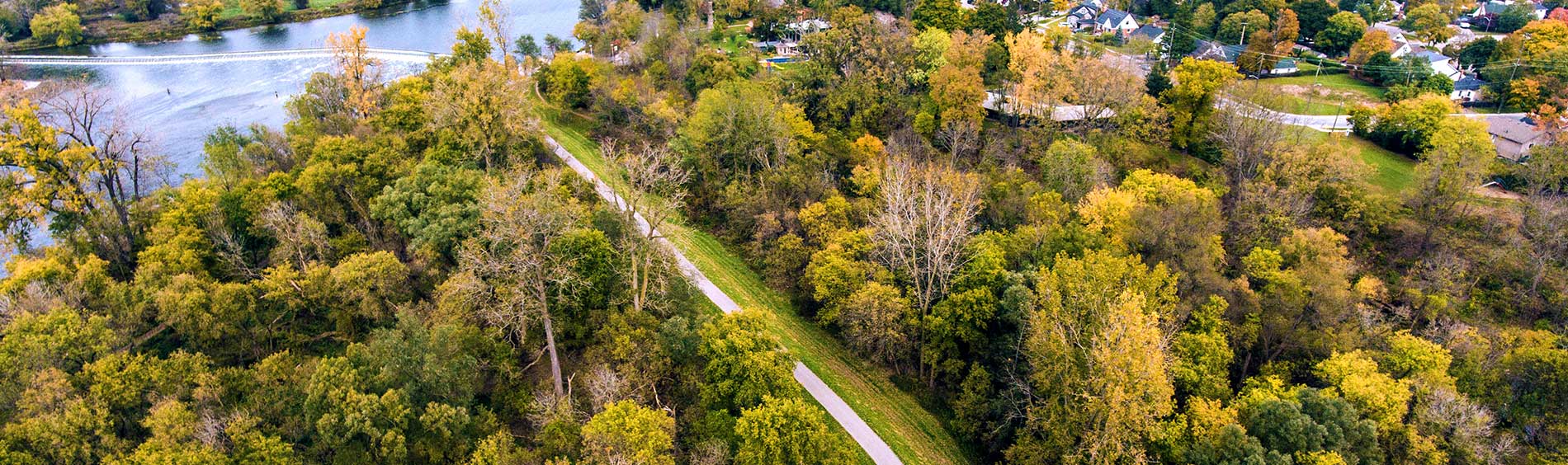


Trails
Most trails within Brantford’s city limits are open. The public is reminded that ATV's, e-bikes and motorized bikes are not permitted on trails. Motorized wheelchairs and scooters used for accessibility are allowed. Bicycles and leashed dogs are also permitted.
Our trail system connects Brantford to other nearby cities including Port Dover, Hamilton, Paris, and beyond. Trails are paved or have a stone surface and are great for running, biking, or hiking. Please note that our trails are not maintained in the winter months and must be used at your own risk.
Trail map
Check our trail map for an overview of our trail system and washroom locations.
Trail closures
Sometimes we have to close our trails to ensure everyone's safety.
| Gilkinson Flats Trail |
| Closed due to water levels; closed under the Veterans Memorial Parkway to the picnic shelter on Mt. Pleasant Road. |
| D’Aubigny Creek Trail |
| Closed due to water levels; closed at Ballantyne boat launch entrance and also closed in the park at the forest trail entrance. |
| Waterworks Riverside Trail |
| Closed due to water levels; closed from the stairs at Wilkes Dam up until the accessibility ramp at Waterworks Park. |
| Cainsville Trail |
| Closed due to water levels; closed from Beach Road to Papple Road. |
| TH & B Trail/CN Trail |
|
Closed due to water levels; closed at Colborne Street East entrance up to Shellards Lane access point, as well as Pleasant Ridge Road access point; Donegal Park access points are also closed. |
| S.C Johnson Trail and Dike Trail closures |
|
Beginning March 5, 2025, until approximately October 31, 2025, the following Trails and Parks will be closed for construction:
The public is asked to avoid construction areas for their safety during the trail and park closures and follow the posted detour routes for pedestrians and cyclists. The map below identifies the areas of parks and trails that are closed for construction as well as the detour routes for pedestrians and cyclists.
Both the Lorne Bridge (Colborne St W) and TH&B Bridge will remain open for pedestrian and cyclist traffic impacted by the trail closures. Additional information can be found on the project page for the Brant’s Crossing Bridge Replacement. Thank you for your patience during construction. |
| Canal Bridge (Drummond Street to Greenwich Street) |
|
The bridge at the canal from Drummond Street to Greenwich Street is closed due to poor conditions. |
| Bridge (Connecting Jaycee Park to Beaver Crescent) |
|
The bridge at the path connecting Jaycee Park to Beaver Crescent is closed due to poor conditions. |

Trail rules
Respecting the following rules and etiquette on trails will help avoid conflicts or injuries so everyone can enjoy trails equally and safely:
- Bicycles are permitted on all shared use trails unless otherwise noted.
- ATV's, motorcycles, e-bikes, motorized bikes, or snowmobiles not permitted on trails.
- Motorized wheelchairs and scooters used for accessibility are allowed.
- Call out or use a bell before passing someone on the trail.
- Pedestrians should move to one side (preferably the right hand side) to allow cyclists to pass.
- Use a light and wear bright clothes at night
- Wear a helmet while biking
- Camping, hunting and fires are not allowed.
- Always be prepared to stop; trail conditions may change quickly
- Respect all posted signs and laws
- Stay on the trail
- Keep your pet on a leash and pick up after them.
- Use the trash cans for your garbage
- Smoking and vaping on City trail property is prohibited
Giant Hogweed
Giant Hogweed is an Asian plant that was introduced to North America over the last century ago and is now spreading throughout southern Ontario.
It can be hazardous to human health. Giant hogweed sap will make a person's skin extremely sensitive to sunlight. Contact with a plant, followed by exposure to the sun, can cause severe burning and blistering. The sap is toxic and eye contact can lead to blindness.
If any sap touches your skin:
- wash the affected area immediately with soap and water
- keep the affected area out of the sun
- see your doctor if you have a reaction
Watch out for lookalikes
Giant hogweed is part of the carrot family and can sometimes be confused with other common plants such as cow parsnip and angelica.
Giant hogweed on City properties
Giant hogweed has been found on City property in a few locations.
The City has a removal protocol to eliminate giant hogweed from its property, but it is a persistent species that is difficult to remove. Options for removal include spraying a herbicide or digging it out. City staff take strict safety precautions when addressing with hogweed.
If you spot giant hogweed
- on your own property, a municipal park or other areas such as along a riverbank or a trail, contact Parks Services 519 759 4150.

 Subscribe to this Page

